instagram

Showing posts with label Streets. Show all posts

Sunday, November 15, 2015

Los Angeles Neighborhoods' Waze Problem

Waze

Given my frustrating hour-long commute from Glendale to Century City, I rely on the Waze app to at least attempt to cut my drive time.

Like many of you, I have a love/hate relationship with Waze. I'm frustrated by the left turns on to busy intersections without a light (when Waze is clearly trying to kill me), and often I'll throw in my own shortcut and see that helps cut Waze's estimated arrival time–which makes me wonder, why didn't Waze suggest that?

Most of the time, Waze throws me on the 10 freeway, which also feels like it defeats the purpose–I never, never used the freeway to commute before Waze came along.

But Waze also sometimes takes me over the hill through residential streets. That's the subject of Joe Flint's recent piece in the Wall Street Journal: how L.A. residents, fed up with Waze-induced traffic jams down their streets, are fighting back:

The music can start blaring at the crack of dawn. That is often followed by loud cellphone conversation, and before too long Melissa Menard, clad in a bathrobe and holding a cup of coffee, confronts the offenders: the caravan of morning commuters driving by her house.

“Everybody loves BeyoncĂ©, but not at 7 a.m.,” she said.

Ms. Menard’s suburban Los Angeles street of ranch houses, Cody Road, has turned into a thoroughfare with enough gridlock to make Times Square at rush hour feel tranquil. On early mornings when headlights are still needed, it resembles one long funeral procession.

The culprit: Waze, the popular app owned by Alphabet Inc. ’s Google that provides alternate routes to busy boulevards and packed freeways. Launched in 2007, Waze has 50 million users world-wide and about two million in Los Angeles, its biggest U.S. market.

Waze sometimes sends drivers through little-used side streets such as Cody Road. The mile-long hilly street in the Sherman Oaks neighborhood runs parallel to the 405 freeway and leads to Mulholland Drive, through which commuters can make their way from the San Fernando Valley to Beverly Hills, Hollywood and West Los Angeles.

It isn’t the only short cut. In L.A.’s ritzy Hancock Park neighborhood, resident Marnie Owens blames Waze for traffic’s doubling on her street.

Waze said it isn’t the problem.

I'm pretty sure I've driven through Cody Road thanks to Waze. I've also seen neighborhoods and parts of town thanks to Waze that I might have otherwise never seen. I'm not sure what the answer is, but let's face it, I'm not sure you could suddenly ban motorists from driving down public streets.

Friday, January 16, 2015

CicLAvia's Next Stop: The San Fernando Valley

ciclavia

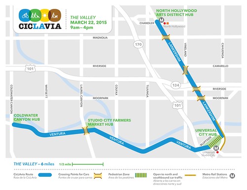
CicLAvia is following the lead of the Great Los Angeles Walk and heading to the Valley! On Sunday, March 22, 2015, from 9am-4pm, the CicLAvia path will follow the final 6 miles of last November's Great Los Angeles Walk path, heading from Studio City to North Hollywood via Ventura Boulevard and Lankershim!

For those of you who walked with us in November, it's another chance to see the Valley up close, this time either on bike or back on foot!

Other CicLAvia events planned for 2015 include:
Pasadena - May 31
Culver City to Venice - August 9
Heart of LA - October 2015


Read all of our past CicLAvia coverage here.

Monday, October 6, 2014

Scenes From CicLAvia, from Echo Park to East Los Angeles

CicLAVia

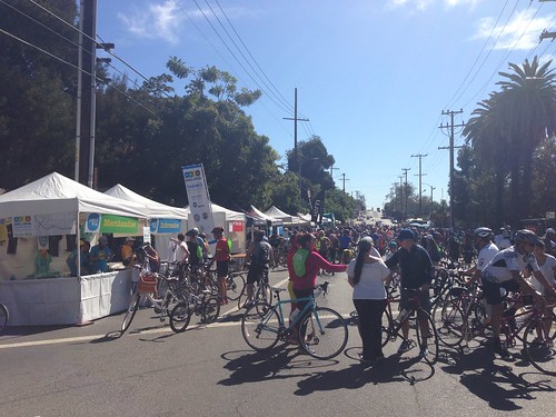
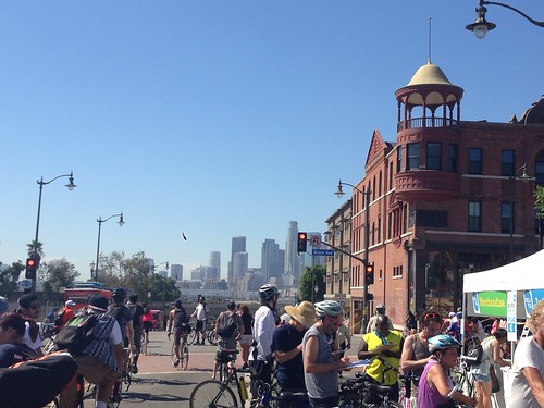
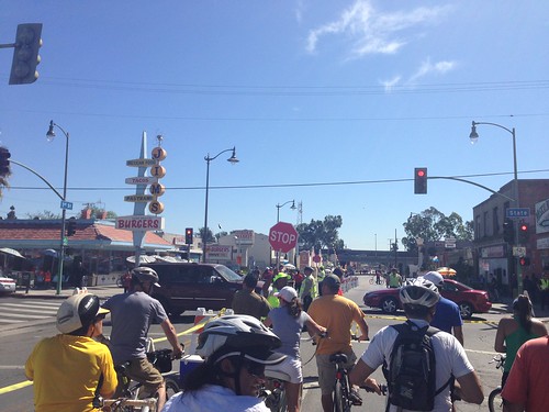
CicLAvia was back this past Sunday, as thousands of Angelenos braved the heat and hit the empty streets with their bikes, skateboards, strollers and other contraptions. I was there, and rode my bike from Echo Park to the East Los Angeles Civic Center and back again -- drinking lots of water and eating many tacos along the way. (That'll be a separate post.) It was a great day -- here are some pics.

CicLAVia
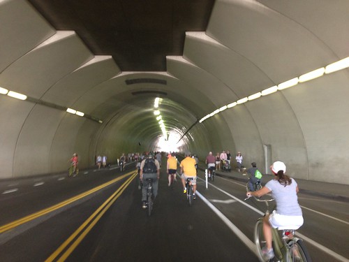
Riding through the famed 2nd Street tunnel -- as seen in virtually every car commercial.

CicLAVia
Riding down Bunker Hill

CicLAVia
At the Echo Park starting point

CicLAVia
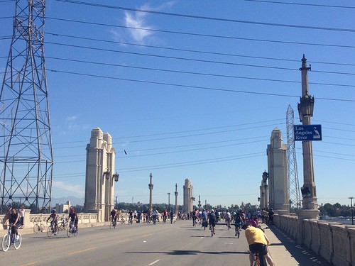
Riding over the bridge spanning the Los Angeles River

CicLAVia
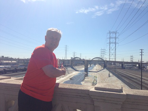
L.A. City Councilmember Tom Labonge -- Mr. L.A. -- shows off the sights from the bridge

CicLAVia
Mariachi Plaza

CicLAVia
The view from Mariachi Plaza

CicLAVia
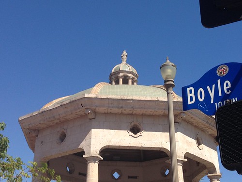
Riding down Cesar Chavez Ave. in Boyle Heights

CicLAVia
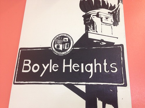
Boyle Heights painting at Guisados

CicLAVia
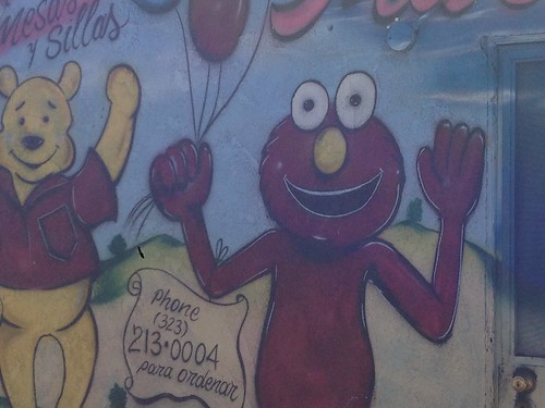
Creepy Elmo!

CicLAVia
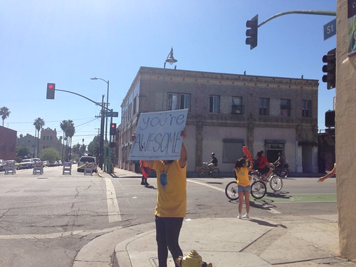
Oh thanks, Cic-LA-Via volunteer, you're awesome too!

CicLAVia
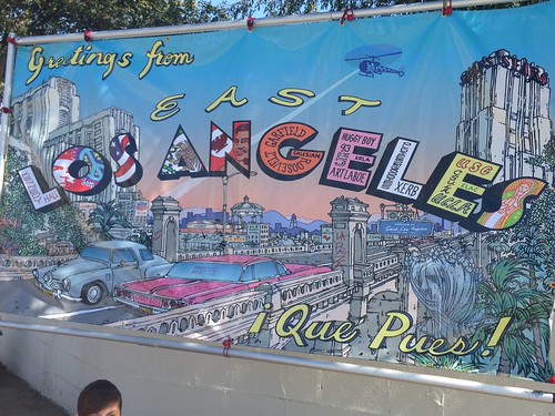
Greetings from East Los Angeles

CicLAVia
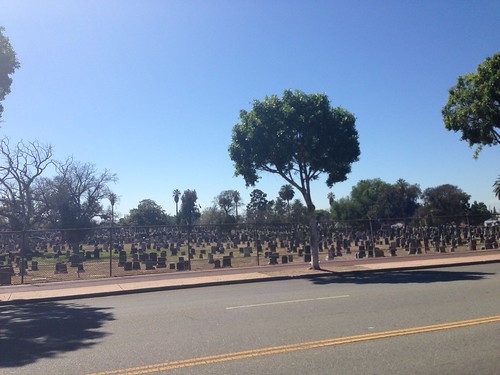
Evergreen Cemetery

CicLAVia
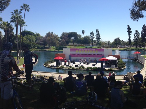
Performances at the East Los Angeles Civic Center -- the eastern hub of this Cic-LA-via

CicLAVia
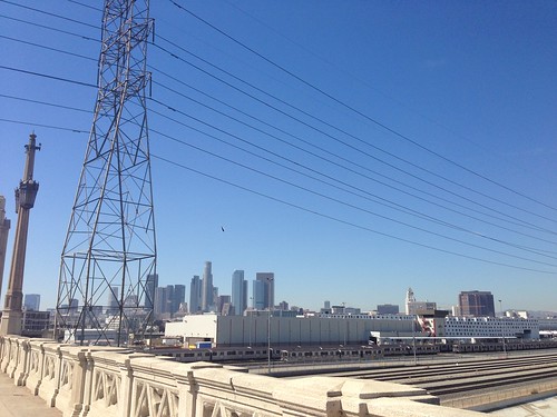
The Los Angeles skyline

CicLAVia
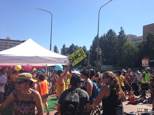
Dance-LA-Via!

Monday, June 2, 2014

A Tale of Two Cities: A Half-Paved Street Frustrates Residents at the L.A./Beverly Hills Border

LA Beverly Hills

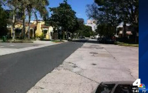
KNBC heads to Gregory Way at the border of L.A. and Beverly Hills and finds a strange scene: A half-paved street. Straight down the middle, half of the street boasts fresh asphalt, while the other side is still riddled with potholes. Yep, the city border goes right down the center of the street.

This isn't exactly a new phenomenon. The same thing frequently happens on the Burton Way median, where the grass is routinely cut -- until you get to L.A., when weeds take over.

It's also not just an L.A. situation. I remember not too long ago, San Fernando Road in Glendale was neatly paved until you got to the border with Burbank -- where cracked asphalt and pot holes took over.

Here's the Channel 4 report:


(h/t to AJ!)

Tuesday, April 2, 2013

The Most Confusing Los Angeles Parking Signs Yet

Street sign

Spotted on Wilshire Boulevard. I dare you to figure out how and when to park here. (I managed to, having found this spot at 7:30 p.m. on a Wednesday -- and left without a ticket!)

Friday, January 18, 2013

Retro Friday: Street Safety in 1930s Los Angeles (Filmstrip)


Don't Be foolish! Obey the Law! Cross Streets Carefully! Think Of Your Parents!

Los Angeles streets in the 1930s look like the Wild West in this safety filmstrip -- but I suppose the whole concept of street culture was relatively new back then. No seat belts, no speed limit, no safety measures to prevent tragedies. This film (no sound, sorry) gives us a glimpse into busy 1930s L.A. surface streets, including the heyday of the Red and Yellow Cars. Watch above.

Sunday, October 9, 2011

Cic-LA-Via Happens Today


It's back, and it's even bigger than before. Cic-LA-Via, which returns on Sunday, Oct. 9, shuts down 10 miles of L.A. roads for the day, as bicycles and pedestrians reclaim the streets.

Read our April account of the last Cic-LA-via here.

Meanwhile, the Militant Angeleno has put together the definitive list of what to see while on Cic-LA-Via; check out his take here.

Hit the streets this Sunday!

Friday, May 27, 2011

Conan Wants a Street; Maybe Try Burbank First?


"Oprah recently got a street in Chicago named after her," writes Conan O'Brien's Team Coco blog, "so Conan thinks it's only fair that he get some random street named after him too."

But... TBS' "Conan" tapes on the Warner Bros. lot in Burbank. I know it takes away from the joke... but then again, I bet Burbank would actually do it. C'mon, Beautiful Downtown Burbank, make it happen!

Friday, April 22, 2011

Farewell, Wilshire Boulevard


It's the end of an era. After 15 years of working on Wilshire Boulevard, I said farewell to the Grand Concourse of Los Angeles this week.

TV Guide just moved its West Coast bureau to Century City, where we have lovely digs across the street from the Century City Shopping Center. That's great -- but having carried my admiration for Wilshire over the years, it's strange to leave a street that has been at the epicenter of my adult life.

I did the math: If you consider I've probably worked between eight and ten hours a day, five days a week, 50 weeks a year (the late nights and days off balance each other out) for 15 years, that comes to about 30,000 hours on Wilshire Boulevard. Considering that the most I've ever lived at any one address is six years -- and that's my current address -- I've easily spent more of my waking hours on Wilshire Boulevard than any other street in the world.

And of course, as you know, we've hit Wilshire twice -- in both 2006 and 2010 -- for the Great Los Angeles Walk.

It all started in 1996 when I moved out here to join the Los Angeles bureau of Electronic Media. EM and all the Crain publications were settled in nicely at 6500 Wilshire Boulevard on the 23rd floor. In 1999, I moved to Variety -- then headquartered at 5700 Wilshire, in the "Wilshire Courtyard" complex made famous as "D & D Advertising" on "Melrose Place." When Variety moved in 2009 to the renamed "Variety Building" at 5900 Wilshire, I was there for the ride. And then, when I joined TV Guide Magazine, our offices were at 8383 Wilshire. Until now.

Wednesday, April 6, 2011

CicLAvia Returns This Sunday


We missed out on CicLAvia last time around, but the event returns to L.A. streets this Sunday, April 10. It's seven and a half miles of closed streets, from East Hollywood to Boyle Heights, between 10 a.m. and 3 p.m. A primer:


CicLAvia makes the streets will safe for people to walk, skate, play and ride a bike. There are activities along the route. Shop owners and restaurants are encouraged to open their doors to people along the CicLAvia.

Will Campbell writes at Blogging.la that last October's original event "was a defining and shining moment for our city."

Here's a video he made of the last CicLAvia:


And read Siel's Five Green Ways to Enjoy CicLAvia here. See you on the streets!

Thursday, September 16, 2010

Los Angeles' Overgrown, Weed-Infested Median Eyesores


It's no secret Los Angeles is gripped by a budget disaster, which has led to unfortunate belt-tightening like the decision to shut down the public library twice a week (an extreme move decision that, the L.A. Weekly notes, was seen as taboo in every other major U.S. city).

But also noticeable in recent weeks: The lack of any lawn care for the city's median dividers. As a result, weeds and grass are growing out of control, and L.A. streets are looking even uglier. The out-of-control median mess sure makes L.A. look bad.


Above: Talk about a tale of two cities. On Burton Way at the Los Angeles/Beverly Hills border. To the left, The City of L.A., where weeds are out of control. To the right, Beverly Hills, with a manicured median.


The Eastsider L.A. looked into L.A.'s median problems a few weeks ago, and hinted that help may be on the way:

Faced with the budget cuts, the city’s Bureau of Street Services has all but eliminated regular median maintenance... Rick Coca, a spokesman for Councilman Jose Huizar, said that medians strips maintained by outside contractors have continued to be cleaned up. It’s the medians once tended by city employees that have been left without care.

Meanwhile, Councilman Tom LaBonge, who represents portions of Atwater and Silver Lake, introduced a City Council motion to use street improvement money to pay city contractors to maintain the Highland Avenue median near Hancock Park and is working with the Department of Public Works to work on other medians in his district.

Councilman Eric Garcetti, who represents Echo Park and Silver Lake, introduced a motion last month to help pay for the maintenance of 2.6-million square feet of medians citywide.

"Without proper maintenance, these medians can become overgrown, litter-strewn eyesores that can drag down an entire neighborhood," he said.

There's truth to that. And if money isn't available, I'd suggest that local business associations band together to trim the medians (via weedwhackers) in their neighborhoods.

Wednesday, September 8, 2010

The Days of Parking for Free at a Busted Meter Are Ending


This past Sunday in downtown, we took advantage of a little-known parking tip: It's OK to park at yellow "loading zone" spots after 6 p.m. and all day Sunday.

Pretty handy. And it may come in even more handy now that L.A. is putting a stop to free parking at busted meters.

Sigh -- it's true. As LAist reports, LADOT is putting stickers up on new meters, warning motorists to either pay through multiple means -- or find another spot. Couple that with the number of pay stations that are replacing meters around town, and the days of scoring a free meter may soon be over.

LAist writes:

f the coin slot is jammed, pay with a credit card. If the credit card swipe won't register, pay with coins. If both don't work, too bad, find another space.

"If you are unable to pay using either the credit/debit card function or cash, you need to move to another parking space," explained LADOT spokesperson Bruce Gillman. "We recommend people call the number on the meter, or simply 311, to report any problems."

The new policy is partly to discourage intentional vandalism that some people have done in the past to park for free.

At least we still have you, Yellow Loading Zone.

Wednesday, November 26, 2008

L.A.'s New Hampshire and Vermont Mystery: Partially Solved


Last week, I asked why New Hampshire Ave. is to the west of Vermont Ave. in L.A., when up in New England, Vermont is the one on the west.

Bob Timmermann, who earlier this year spoke about Sepulveda Blvd. at the Central Library, did some digging:

From my half-assed sleuthing at the Central Library, the reason why Vermont Ave and New Hampshire Ave in L.A. are backwards in relation to the states is due to the fact that the streets weren't named at the same time.

Vermont is a very old street in L.A. terms. It first shows up in 1866. New Hampshire wasn't built and named until 1887, when it was part of one of the developments that sprung up in Southern California during Real Estate Boom I.

Next year at the Central Library, I plan to follow up on my Sepulveda trip with a journey down Western Avenue. Unlike Sepulveda, this should have slightly better scenery and fewer trucks.

Thanks Bob!

Thursday, November 20, 2008

L.A. Mystery: Vermont and New Hampshire


Up in New England, Vermont is to the west of New Hampshire. So why then...


... is L.A.'s Vermont Ave. to the east of New Hampshire Ave.? Any city nerds out there with the answer?

Thursday, September 14, 2006

Los Angeles Resumes Dotting Its "i"s on City Streets


I've started noticing a new look on certain street signs, including the ones at the intersection of Wilshire and Western (above) and Olympic and Western. The font is different -- it's a thinner, more modern-looking sans serif, on a deeper blue background.

But something even more dramatic caught my eye: The "i"s are dotted.

Yup, the dots have returned. If you haven't noticed, the most recent edition of Los Angeles' street name signs had strangely avoided placing dots in lower-case "i"s. Last year, blogging.la guest contributor Jogannes Grenzfurthner (visiting from Vienna) noticed:

Where are the dots on the 'i's?
Saving money?
Fancy font?
Mysterious pattern conspiracy?

Here's a street name sign for Wilshire without the dotted "i"s:


I tried calling the city to ask them -- but they had no idea what I was talking about. Actually, the woman on the other end at first thought I was referring to an intersection in West Hollywood. ("I'm sorry sir, but I don't think that intersection is in Los Angeles.")

I guess we'll have to live with the mystery for now. Is Los Angeles introducing a new style for its street name signs? Did the city indeed conciously bring back the dotted "i"? And most importantly, why am I so interested in geeky stuff like this?

I'm about to get even geekier on you. I've for years wondered about the chronology of what appears to be the three different style of street name signs in Los Angeles. (If there are more, please let me know... but it seems as if these are the three I see everywhere).


The classic, all-caps street name sign. This is the one on top of Franklin Avenue, obviously. It's the oldest style, boasting all caps and a deep, dark blue background. It's my favorite of the three.


The multi-level street name sign. Of the three, I probably see these the least. Nothing too special here, other than the fact that the street name and the block numbering are printed on two separate signs that are attached , or can be removed individually.


The modern, dot-less street name sign. The one in most common use today. Boasts the cool flair design, in which the edge of the street name sign is cut at an angle.

Anyone (as usual, LA City Nerd, I'm looking at you) know the history/chronology of L.A.'s three street name signs? Please share!