instagram

Showing posts with label Maps. Show all posts

Friday, February 19, 2016

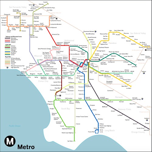
Dare to Dream: Los Angeles' Metro System in 2040?

Metro

Chris Nichols over at Los Angeles magazine writes that Metro has posted a map of what our local rail system might look like in just 25 or so years. " love this prediction that 2040 will bring extensions to almost every subway and light rail line, lots of new Rapid buses, a high-speed elevated line to Santa Ana, and a bullet train to San Francisco. In a few weeks the Gold Line to Azusa and the “subway to the sea” Expo Line to Santa Monica will debut," Chris writes.

Per Metro, this map "is an imagined rendering created by Jake Berman of Studio Complutense . But it definitely gets you thinking!

Friday, September 26, 2014

What's The Real Dividing Line Between Silver Lake and Echo Park?

Transparent

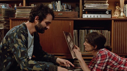
In an early episode of Amazon's "Transparent," a character tells Josh (Jay Duplass) that she doesn't even know the dividing line between Silver Lake and Echo Park. "Rampart," Josh says in passing, almost dismissively.

Is that true? Is Rampart the dividing line between Silver Lake and Echo Park? According to Google Maps, the boundary is more complicated:

Silver Lake

What say you, hipsters?

Wednesday, June 8, 2011

Map Your L.A. For KCET


One of my favorite L.A. books of the past year has been Los Angeles in Maps by Glen Creason -- but then again I'm a sucker for both maps and all things old Los Angeles.

Inspired in part by the book, KCET's Departures blog is asking readers to come up with their own maps of L.A. Details:

As a partner in Departure's effort to share information and ideas about L.A., we want you to share your personal maps in order to expand our understanding L.A. Here are some ideas to get you started:

Map your family's history in L.A. Mark changes in time and community.

Define your borders in L.A. Where is your work, home, play, soccer game, etc?
Map art in your commute, including graffiti, public art, or something you find beautiful on a daily basis.

Share your "legends" in L.A. by mapping your favorite L.A. local eccentrics, and favorite strangers. For extra brownie points, include a legend for your map.
It's a fun idea. I've been trying to figure out what my "Map of L.A." would be -- my (now terrible) commute? Favorite go-to restaurants? Kid-friendly L.A.?

Sunday, March 27, 2011

How to Find the Best Coffee in Los Angeles


Coffee addicts, pay attention: The LA Weekly has put together the definitive list of L.A.'s best spots to get a cup -- check out the criteria here and the map here.

The Weekly explains:

A few days ago, we listed 10 Places to Get a Damn Good Cup of Coffee. As many of you pointed out (passionately) in our comments, however, there are coffee shops not on the list that also make a great cup. And so, for your handy reference, we mapped L.A.'s best specialty coffee shops. The map includes the spots we highlighted, plus several others that didn't make the list. We made note of the shops that select and roast their own beans (those shops are in all caps), so if you want to drink local, you can.
Check out the original "Top 10 Places to Get a Damn Cup of Coffee" feature here.

Among the top offerings:
1. Espresso Cielo
2. Balconi Coffee Company
3, Coffee Commissary
4. Farmers' Markets
5. Cafecito Organico
​6. Spring for Coffee
7. CoffeeBar
8. Intelligentsia
9. Cognoscenti Coffee
10. Cafe de Leche

A few of our favorite (and soon-to-be favorite) places!

Monday, October 25, 2010

Why Downtown L.A.'s Street Grid Is At An Angle


It's baffled me for eons: Why is downtown Los Angeles laid out at an angle (36 degrees, to be exact), rather than north-south?

Angelenos know that they're not actually facing north when looking up Broadway, Main or Spring Streets (or any street for that matter). Yet the brain has a way of playing tricks on us; it's still hard to convince yourself that you're actually peering toward the northeast.

But then, suddenly at Hoover, the grid rights itself. To the west of Hoover, L.A. streets are indeed laid out north-south and east-west. What gives?

Local historian and author D.J. Waldie has the answer (it's a Spanish colonial thing), via a lively op-ed piece in Sunday's L.A. Times:

Royal ordinances required that the streets and house lots in the cities of New Spain have a 45-degree disorientation from true north and south to provide, it was said, equal light to every side of a small house throughout the day. Given the way Spanish and then Mexican Los Angeles extended along the bank of its uncertain river, only 36 degrees of compliance was possible.

The 1849 Ord and Hutton survey, which produced the first map of the newly American city, left the puzzle of royal versus republican orientation unresolved. The map pictures a longitudinal city and used facts on the ground — the bed of the Los Angeles River — as an organizing principle. Faint, spidery lines intersecting at the town plaza hint at compass points the map otherwise ignores.

As the city began to sell itself into the future in the 1870s, Ord's map was blended with newer real estate surveys. They too show the city within the grid of its founding. House lots and streets continue to replicate its off-kilter orientation, as they will until the boom times that followed the arrival of the transcontinental railroads at the end of the 19th century.

Waldie wrote the forward to the brand new book Los Angeles in Maps (a great gift for the holidays, hint-hint), from which the map above was taken.

Also in the Sunday L.A. Times: Remembering Sarah Bernhardt's 1913 car accident -- among the first ever reported for an entertainment figure. The crash eventually forced Bernhardt to amputate her leg.

Monday, November 16, 2009

Metro's Gold Line Map Inconsistency


Yes, I love to be nitpicky on some things -- and it especially bugs me when things aren't consistent. Take the new Gold Line map found on the Metro, which divides the train's stops by city: Pasadena, South Pasadena, Los Angeles, Boyle Heights and East Los Angeles.

Wait. One of these things is not like the other. Boyle Heights is not a city, but a community within Los Angeles City Limits.

That'd be fine, I suppose, except that the map chooses not to recognize other L.A. neighborhoods. Why the love for Boyle Heights, but not Highland Park? Chinatown? Little Tokyo?

Yes, like I said, nitpicky. But someone's gotta be!

Thursday, February 19, 2009

L.A. Times Unveils Its Los Angeles Map, Braces for Deluge of Response


There are few subjects more controversial to Angelenos than how they describe their neighborhoods. The debate over where the "Westside" and "Eastside" are has been waged for years. And neighborhood boundaries are hotly contested, particularly when it comes time to sell your house or compute property values.

After years of getting grief over using conflicting neighborhood names, the Los Angeles Times is trying harder to get it right. The paper just unveiled its Mapping L.A. initiative, an evolving map of Los Angeles neighborhoods.

Bob Pool writes about the map:

Years in the making, it is designed to be a tool that will allow reporters and editors to be consistent when describing neighborhoods in news stories in a city that sometimes seems to change the names like most people change socks.

Dorothy Parker famously said Los Angeles was "72 suburbs in search of a city," so it's not surprising that residents take their neighborhood names so seriously. Those designations are part tradition and history -- but also part economic and political. Many residents see big differences in property value if you live in tony Hancock Park as opposed to more working-class Mid-City.

In the Valley, there's a grand tradition of seceding from traditional neighborhoods. Parts of gritty Van Nuys have become Valley Glen and Lake Balboa, while a portion of Canoga Park re-christened itself West Hills...

Fortunately, those who disagree with the map have a chance to persuade the newspaper's mapmakers to reconsider. Readers can use the interactive website to redraw any section of the map they feel is incorrect and submit the alteration for editors' consideration. And editors may be busy.

The L.A. Times map doesn't get into hyper-specific neighborhoods -- although you could argue that it needs to include more, such as Little Tokyo.

The city of Los Angeles currently recognizes 172 communities, at least according to the late, lamented L.A. City Nerd. (The Nerd's campaign to photograph every L.A. neighborhood sign lives on, via Flickr.)

LAist also recently embarked on a project to designate L.A. neighborhoods.

Friday, October 17, 2008

Mapping Los Angeles


I'll definitely have to head down to the Central Library soon to check out "L.A. Unfolded," which showcases some of the library's massive collection of Los Angeles maps.

The L.A. Times' Bob Pool
makes a visit:

There's the mysterious "Mesmer City," shown in 1924 as prosperously thriving between Culver City and Mar Vista. It turns out the detailed map was a subdivision promoter's dreamy depiction of what life could be like at homesites "in the direction of Los Angeles' growth toward the ocean."

That growth eventually arrived, but Mesmer City didn't.

A 1903 road map showing owners of the city's 1,600 automobiles where dirt roads were safe enough to drive at 8 mph is included. With an eye toward more sales, cartographer Henry Rueger labeled his creation "Rueger's Automobile and Miners Road Map" so he could tap into the vein of potential local prospectors and speculators.

One of Hollywood's first movie star maps is there -- John Tyler's 1945 "Guide Thru Starland" that pinpoints the homes of Harold Lloyd, Groucho Marx, Walter Pidgeon and dozens of their peers.

The late, lamented L.A. City Nerd put together a list of excellent online L.A. map resources a while back; check out my post on it, complete with links, here.

Friday, April 13, 2007

Monorails! "New Red Cars!" A "Backbone Route"! And Other Failed L.A. Rapid Transit Plans


Portion of the 1925 Rapid Transit Plan -- note that West Hollywood is still referred to by its original name, "Sherman," while another long-lost neighborhood, "Edendale," is also listed.

The L.A. Times' Bottleneck Blog, one of the best of the paper's blogs, turned me on to the MTA's cool Dorothy Peyton Grey Transportation Library, specifically its Metro Archives.

The library collection itself "contains over 20,000 photographs, films, audio tapes, hundreds of video tapes, and various ephemera, books, journals, and artifacts documenting the role of public transportation back to 1873, including all of the predecessor public transportation providers/agencies that operated in the Greater Los Angeles area." That includes a big chunk of info, maps and pictures that have been uploaded to the web.

Check out these shots from L.A.'s 1963 transit plan:


Exterior


System Map

Also, check out this 1954 Fortune article on proposals to build a Monorail in Los Angeles. (Some things never change -- the debate over whether a monorail still might make sense for L.A. rages on, at least in the comments section of this Bottleneck Blog post.)

I always find "what could have been" designs fascinating (as my recent posts on abandoned Civic Center and Ambassador Hotel plans can attest) and could probably spend hours poking around this site.

More maps -- including plans from 1925 to 2003 -- can be found here.

Friday, March 2, 2007

Mapping Los Angeles


The LA City Nerd does it again, this time compiling an extensive list of Los Angeles maps.

My faves include some of the historical maps the LA City Nerd includes on his/her list. A sampling:

  • Annexation Map

  • Los Angeles County Historical Topographic Maps

  • Historic Earthquakes

  • 1849 Los Angeles City Plan map

  • 1927 Development Map for the San Fernando Valley

  • 1935 Los Angeles and Vicinity

  • 1939 Los Angeles Highways

  • 1943 Street Map

  • 1962 San Fernando Valley

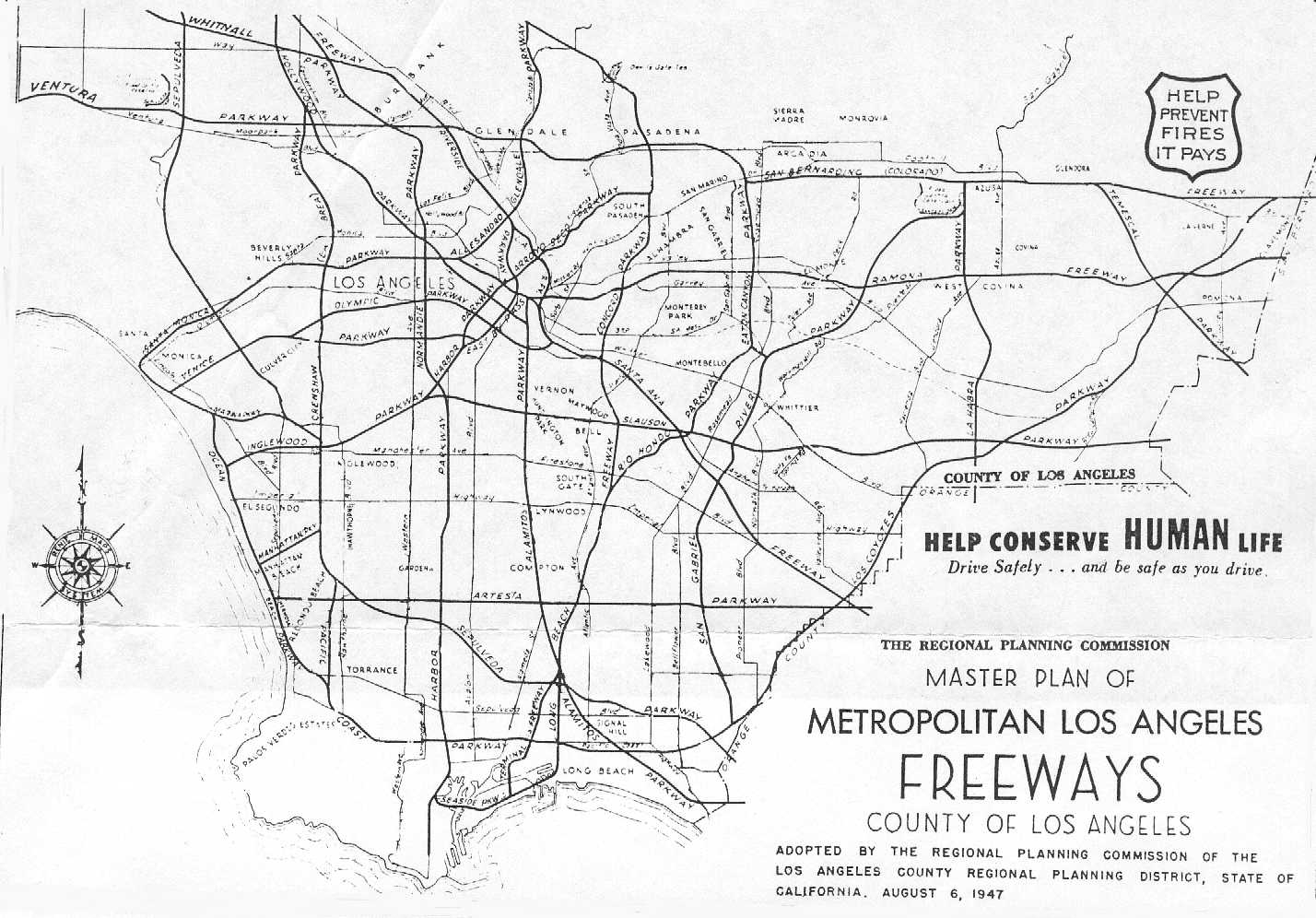
  • Metropolitan Freeway Plan (1947)

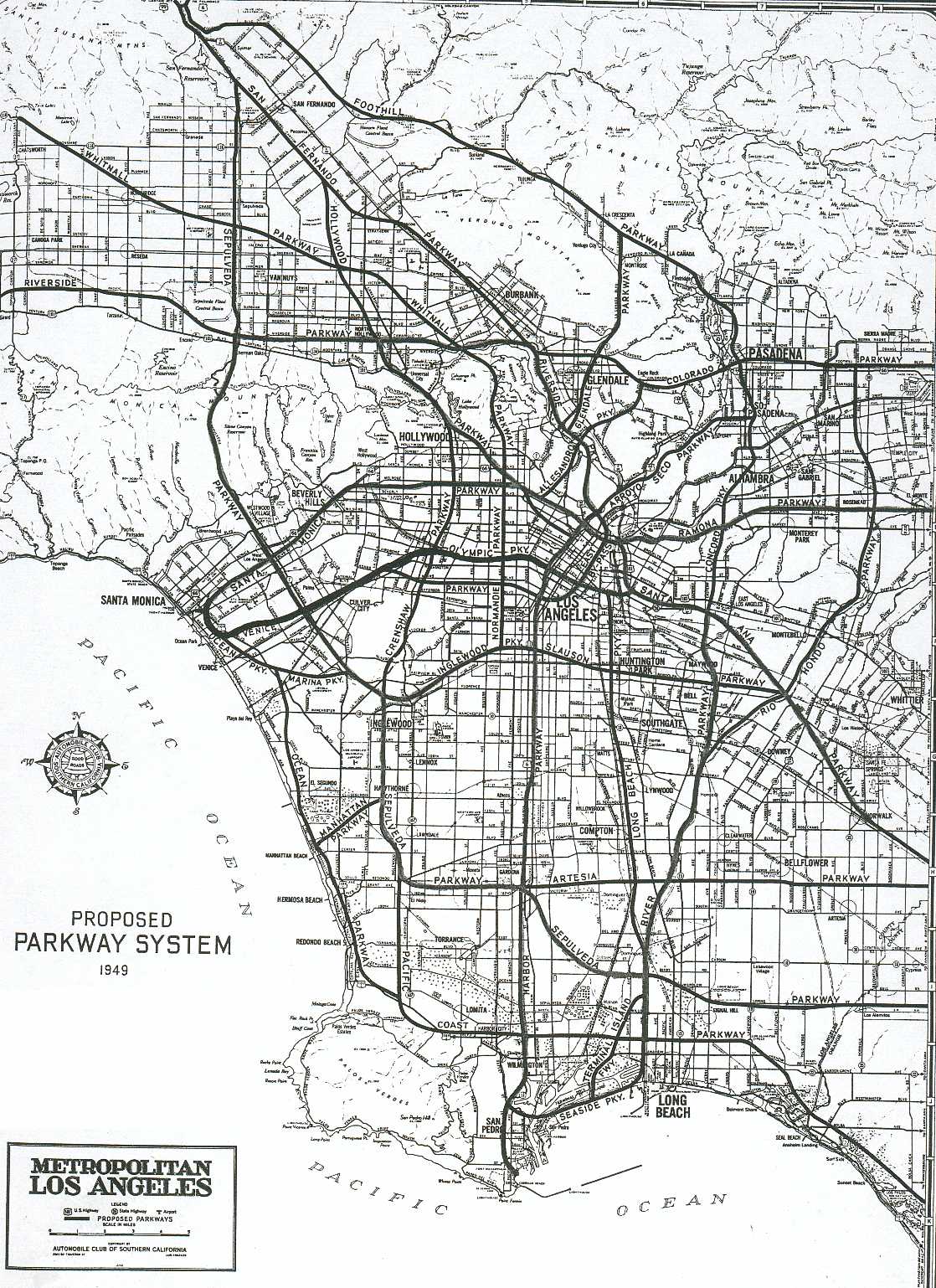
  • AAA Los Angeles Freeway Plan (1949)

  • Los Angeles Freeway Plan

  • I've seen some of those proposed freeway maps before; it's fascinating to imagine how the city might look today if those parkways were actually built. Cheers to LA City Nerd for putting all of this together -- check out his/her site for the comprehensive list.